JAC Board Class 10th Social Science Solutions Geography Chapter 7 Lifelines of National Economy
JAC Class 10th Geography Lifelines of National Economy InText Questions and Answers
Page 80
Question 1.
Find out places linked by the National Highway 2 and 3.
Answer:
National Highway 2 – Delhi to Kolkata National Highway 3 – Agra to Mumbai
Page 82
NCERT ‘Activity’
Question 2.
Find out the current Railway zones and their headquarters. Also locate the headquarters of Railway zones on the map of India.
Answer:
| Zonal Railways | Headquarters |
| 1. Central Railway | Mumbai |
| 2. Eastern Railway | Kolkata |
| 3. Northern Railway | New Delhi |
| 4. North-Eastern Railway | Gorakhpur |
| 5. North-East Frontier Railway | Maligaon |
| 6. Southern Railway | Chennai |
| 7. Southern-Central Railway | Secunderabad |
| 8. South-Eastern Railway | Kolkata |
| 9. Western Railway | Mumbai |
| 10. East-Central Railway | Headquarters |
| 11. East Coast Railway | Hazipur |
| 12. North-Central Railway | Bhubaneshwar |
| 13. North-Western Railway | Prayagraj |
| 14. South-East Central Railway | Jaipur |
| 15. South-Western Railway | Bilaspur |
Follow the given table and locate the points on the map.
Question 3.
Railway line has been extended from Banihal to Baramula in the Kashmir valley. Locate these two towns on the map of India.
Answer:
Do it yourself
Page 86
Question 4.
Why is air travel preferred in the north-eastern states?
Answer:
Air travel is preferred in the north-eastern states because it is difficult to construct roads or railways on the uneven terrain in the north-eastern states. It can easily cover difficult terrain, big and wide rivers (e.g., Brahmaputra), dissected relief (many river valleys between places), dense forests, frequent flooding and also some international frontiers (Bangladesh), etc.
![]()
Question 5.
Find out the names of the countries connected by Air India.
Answer:
The countries connected by Air India are: France, Canada, Germany, Israel, Japan, UK, Bangladesh, UAE, Kenya, USA, Australia, Italy, etc.
Page 89
Question 6.
On the map of India show important tourist places of your State/UT and its connectivity with other parts of the country by ailways/roadways/airways.
Answer:
Do it yourself.
JAC Class 10th Geography Lifelines of National Economy Textbook Questions and Answers
Question 1.
Choose the right answer from the four alternatives given below.
(i) Which two of the following extreme locations are connected by the east-west corridor?
(a) Mumbai and Nagpur
(b) Silchar and Porbandar
(c) Mumbai and Kolkata
(d) Nagpur and Siligudi
Answer:
(b) Silchar and Porbandar
![]()
(ii) Which mode of transportation reduces trans-shipment losses and delays?
(a) Railways
(b) Roadways
(c) Pipeline
(d) Waterways
Answer:
(c) Pipeline
(iii) Which one of the following states is not connected with the H.V.J. pipeline?
(a) Madhya Pradesh
(b) Maharashtra
(c) Gujarat
(d) Uttar Pradesh
Answer:
(b) Maharashtra
(iv) Which one of the following ports is the deepest land-locked and well protected port along the east coast?
(a) Chennai
(b) Paradip
(c) Tuticorin
(d) Vishakhapatnam
Answer:
(d) Vishakhapatnam
![]()
(v) Which one of the following is the most important modes of transportation in Indian
(a) Pipeline
(b) Railways
(c) Roadways
(d) Airways
Answer:
(c) Roadways
(vi) Which one of the following terms is used to describe trade between two or more countries?
(b) International trade
(c) External trade
(d) Local trade
Answer:
(b) International trade
Question 2.
Answer the following questions in about 30 words.
(a) State any three merits of roadways.
(b) Where and why is rail transport the most convenient means of transportation?
(c) What is the significance of the border roads?
(d) What is meant by trade? What is the difference between international and local trade?
Answer:
(a) Three merits of roadways are:
- Construction cost of roads is much lower than that of railway lines.
- Roads can traverse comparatively much dissected and undulating topography.
- Roads can negotiate higher gradients of slopes and as such can traverse mountains such as the Himalayas.
(b) The northern plains with their vast level land, high population density and rich agricultural resources provide the most favourable condition for the growth of rail transportation.
(c) Border Roads Organisation, a Government of India undertaking constructs and maintains roads in the bordering areas of the country. This organisation was established in 1960 for the development of the roads of strategic importance in the northern and north-eastern border areas. These roads have improved accessibility in areas of difficult terrain and have helped in the economic development of these areas.
(d) Trade is the movement of goods and services between regions of economic gain. Trade between two or more countries is termed as International trade, It takes . place through sea, air or land routes. While trade occurring in a region within the same country is called local trade. It takes place in the local markets.
Question 3.
Answer the following questions in about 120 words.
(a) Why are the means of transportation and communication called the lifelines of a nation and its economy?
(b) Write a note on the changing nature of the international trade in the last fifteen years.
Answer:
(a) The means of transportation and commurfication are called the lifelines of a nation and its economy because these are prerequisite for the economic development of the country. Transportation connects one part of the country to the other part. This helps in movement of goods and people from one region to the other.
![]()
Industries cannot manufacture goods if the raw materials and finished goods are not transported from one place to the other. Agriculture also depends on transportation as the grains are needed to be transported to the market places. Development of various means of communication has been one of the major factors Miich have facilitated the process of globalisation. Telecommunication systems and the internet have helped in the -development of trade and business activities.
(b) Trade between two countries is called international trade. It may take place through sea, air or land routes. Advancement of international trade of a country is an index to its economic prosperity. It is, therefore, considered the economic barometer for a country. India has trade relations with most of the countries in the world. Her share of international trade has been on an increase in the last few years.
(i) India mainly exported agricultural and allied products gems and jewellery, chemicals and related products.
(ii) Petroleum and petroleum products, gems and jewellery chemicals related products, base metals, electronic items and machinery are some important items of import. India has emerged as a software giant at an international level. It has been earning foreign exchange through the export of information and technology.
NCERT ‘Quiz Drive’
- Northern terminal of the North-south corridor.
- The name of National Highway No. 2.
- The headquarter of the southern railway zone.
- The rail gauge with a track width of 1.676 m.
- The southern terminal of the National Highway No. 7.
- A Riverine Port.
- Busiest railway junction in Northern India.
Answer:
- Srinagar
- Sher Shah Suri Marg
- Chennai
- Broad Gauge
- Kanyakumari
- Kolkata Port Trust
- Mughalsarai
NCERT ‘Activity’
Start your search vertically, horizontally or diagonally and reach various destinations across the country!
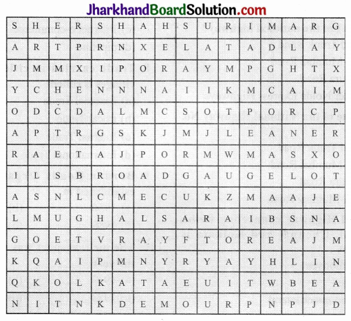
Answer: